Editing floor plan
Proximi.io portal has two editing modes: edit wayfinding and edit floor plan. In edit wayfinding mode you are able to edit, add, and remove points of interests and paths as well as edit text. In edit floor plan mode you will be able to add, edit, and remove polygons and text. Points of interests (POI) are the different items your venue's visitors will be searching for. Depending on the venue type, they could be for example shops, offices, platforms, or different attractions. These two modes can be found from the right lower corner of the portal.
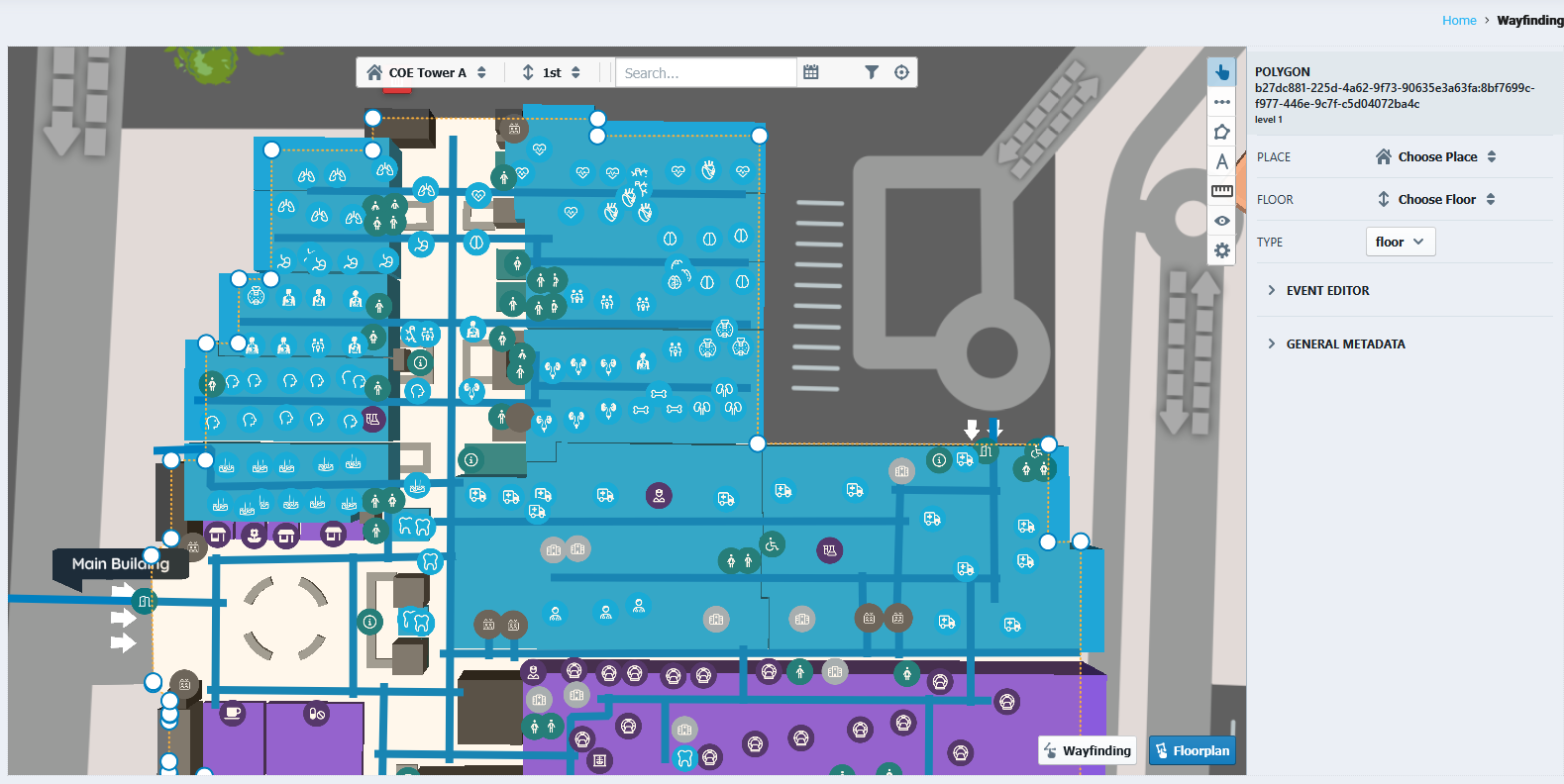
From the upper menu you can change buildings, levels and search for POIs.

Edit floor plan
Select tool
With select tool you can select any polygon on the map to access the information. Selecting a polygon that has polygons under it will open a menu with all the individual polygons in that area.


After selecting the polygon, you can add more points by clicking one of the white circles. The shape of the polygon changes when you drag one of the points.

|

|
Changing the type of the polygon happens from type drop down menu. No need to specify place and floor in a polygon that is already in the portal.

Add polygon
Add polygon tool lets you create new polygons and assign a correct type for them. The default type will be the first type on the list.

|

|
Delete polygon
Deleting a polygon happens by clicking the polygon, choosing the polygon you want to delete if there are many, and pressing the red trash bin.

Splitting a polygon to two
Splitting a polygon to two is done by reducing the size of the current polygon and creating a new polygon next to it. Click on the select tool and resize the polygon to the wanted size.

|

|
Then choose "add polygon" tool and create a new polygon next to the original one. Save the changes.

Add text
Text can be added to the portal by the "add text" tool. The default setting for the tool is to display only text, additional styles (e.g. background tag) need to be added from the style.
|
|

|

Floor editing
Floor is a polygon that can be added to cover the indoor floor space. Floor editing is off by default and can be turned on from the settings - manage map pitch, bound etc. When this selection is turned on, you are able to add, edit and remove floors.

|

|
Polygons at a specific area can be checked by going to "Settings" - "Inspect Map Elements" and hoovering the mouse on the are you want to inspect.

Saving changes
After making changes, a red arrow appears on the left side of the upper menu panel. By pressing it you will save all the changes you have made and they will be reflected on the wayfinding map. The recommendation is to save the progress after every edit.
