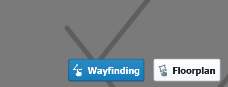
Editing wayfinding
Proximi.io portal has two editing modes: edit wayfinding and edit floor plan. In edit wayfinding mode you are able to edit, add, and remove points of interests and paths as well as edit text. In edit floor plan mode you will be able to add, edit, and remove polygons and text. Points of interests (POI) are the different items your venue's visitors will be searching for. Depending on the venue type, they could be for example shops, offices, platforms, or different attractions. These two modes can be found from the right lower corner of the portal.
From the upper menu you can change buildings, levels and search for POIs.

Edit wayfinding
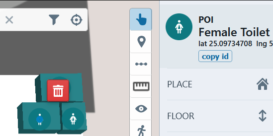
Select tool
With select tool you can select any POI, text, or path on the map to access the information and settings. You can edit the information or delete the item you selected.

|

|
Add point
With add point tool you can add a POI to the map.

Add path
With add path tool you can add a path to the map.

Saving changes
After making changes, a red arrow appears on the left side of the upper menu panel. By pressing it you will save all the changes you have made and they will be reflected on the wayfinding map. The recommendation is to save the progress after every edit.
